


News
Share
Published 17:37 2 Mar 2019 GMT
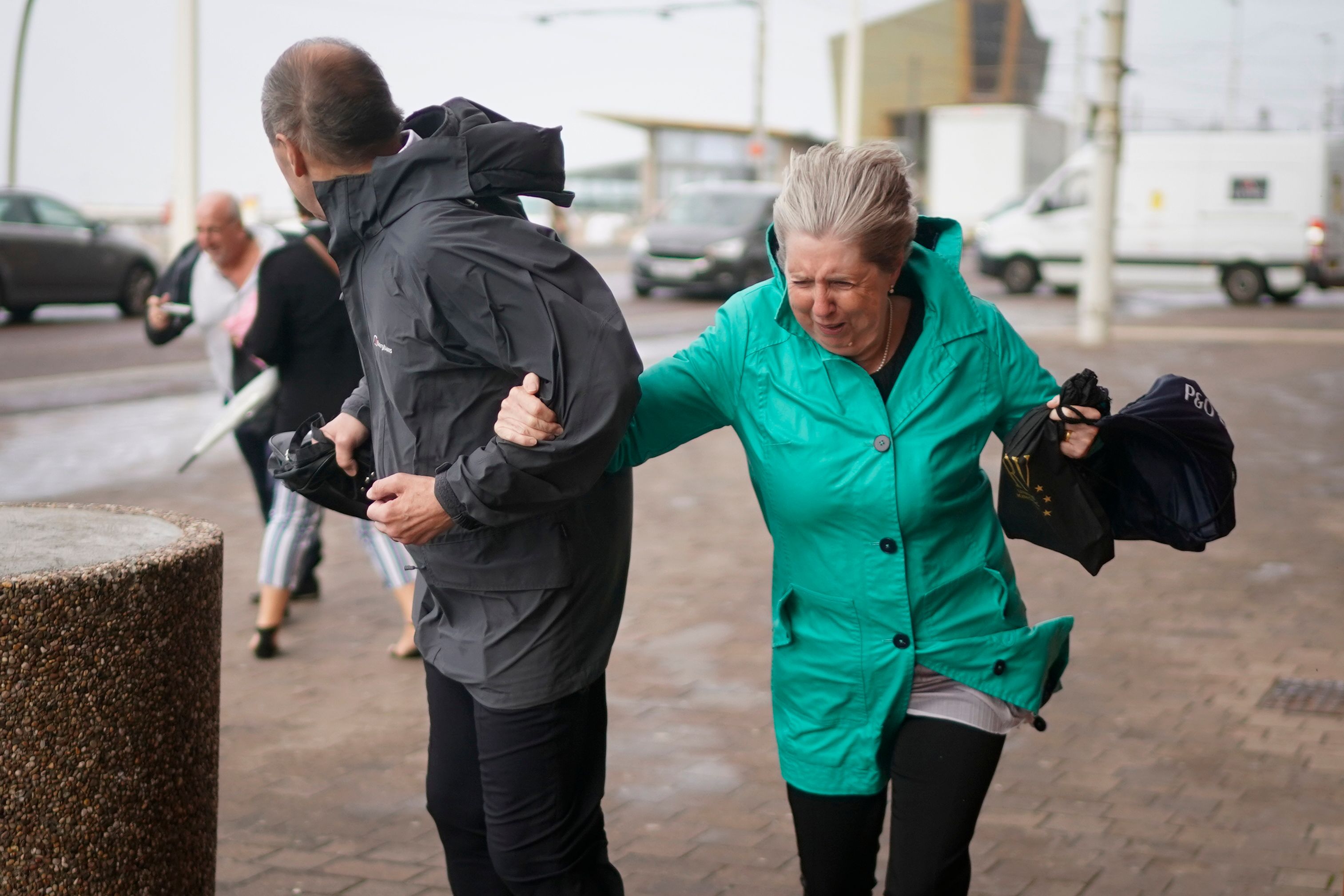 Members of the public struggle in the wind during Storm Ali (Credit: Christopher Furlong)[/caption]
Highways England’s Head of Road Safety, Richard Leonard, said: "We’re encouraging drivers to check the latest weather and travel conditions before setting off on journeys and consider if their journey is necessary and can be delayed until conditions improve. If you do intend to travel, then plan your journey and take extra care, allowing more time for your journey.
"In high winds, there’s a particular risk to lorries, caravans and motorbikes so we’d advise drivers of these vehicles to slow down.
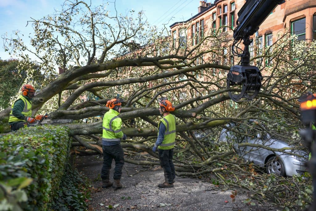
"Drivers of other vehicles should be aware of sudden gusts of wind which can affect handling and braking, and give high-sided vehicles, caravans, and motorbikes plenty of space. In the event of persistent high winds we may need to close bridges to traffic for a period, so please be alert for warnings of closures and follow signed diversion routes."
Looking ahead to next week, Deputy Chief Meteorologist Jason Kelly, said: "As Storm Freya moves into the North Sea on Monday so too will the strongest winds. The rest of the week will be largely unsettled with further spells of wet and windy weather, but some fair weather and sunshine in places too."
Members of the public struggle in the wind during Storm Ali (Credit: Christopher Furlong)[/caption]
Highways England’s Head of Road Safety, Richard Leonard, said: "We’re encouraging drivers to check the latest weather and travel conditions before setting off on journeys and consider if their journey is necessary and can be delayed until conditions improve. If you do intend to travel, then plan your journey and take extra care, allowing more time for your journey.
"In high winds, there’s a particular risk to lorries, caravans and motorbikes so we’d advise drivers of these vehicles to slow down.
"Drivers of other vehicles should be aware of sudden gusts of wind which can affect handling and braking, and give high-sided vehicles, caravans, and motorbikes plenty of space. In the event of persistent high winds we may need to close bridges to traffic for a period, so please be alert for warnings of closures and follow signed diversion routes."
Looking ahead to next week, Deputy Chief Meteorologist Jason Kelly, said: "As Storm Freya moves into the North Sea on Monday so too will the strongest winds. The rest of the week will be largely unsettled with further spells of wet and windy weather, but some fair weather and sunshine in places too."Explore more on these topics:

News

News

News

News
Weather chart shows exact date UK faces hottest day in history
It looks like a long summer Weather forecasting models suggest temperatures could hit 41C in parts of the UK next week, while the Met Office says another heatwave is on the cards Brits could soon find themselves facing yet another heatwave as the UK may see its hottest day ever. According to the Met Office, […]
News
2 weeks ago
Government issues statement on maximum working temperature as heatwave fries UK
It comes as the UK experienced its hottest ever June day this week Brits across the country are feeling the heat, as the mercury soars this week, and red weather warnings being issued for parts of the country. Earlier this week the previous amber warning was upgraded to a red ‘danger to life’ extreme heat […]
News
3 weeks ago
Six UK areas hit with avalanche warnings as amber ‘hazard’ issued
News


