


News
Share
Published 13:24 31 Aug 2021 BST
Updated 13:24 31 Aug 2021 BST

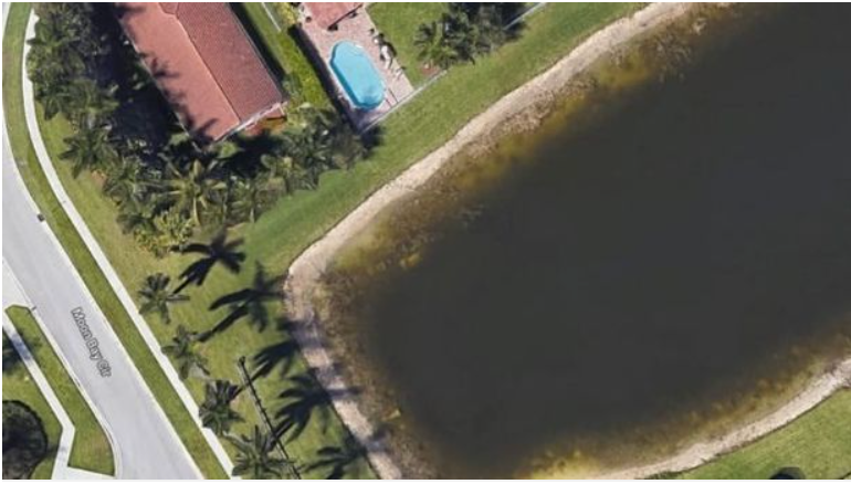 Google Maps[/caption]
The location was only a construction site when the missing persons report was filed, but the development has since grown, leading the manager of The Grand Isles housing development to spot the car.
The Charley Project, an online database collecting information on US cold cases, says it's possible the car was visible on Google Maps for more than 10 years.
It writes: "Amazingly, the vehicle had been plainly visible on a Google Earth satellite image of the area since 2007, but apparently no one had noticed it until 2019 when a property surveyor saw the car while looking at Google Earth."
Police spokeswoman Therese Barbera said at the time: "You can't determine what happened that many years ago, what transpired.
"All we know is that he went missing off the face of the Earth, and now he's been discovered."
Google Maps[/caption]
The location was only a construction site when the missing persons report was filed, but the development has since grown, leading the manager of The Grand Isles housing development to spot the car.
The Charley Project, an online database collecting information on US cold cases, says it's possible the car was visible on Google Maps for more than 10 years.
It writes: "Amazingly, the vehicle had been plainly visible on a Google Earth satellite image of the area since 2007, but apparently no one had noticed it until 2019 when a property surveyor saw the car while looking at Google Earth."
Police spokeswoman Therese Barbera said at the time: "You can't determine what happened that many years ago, what transpired.
"All we know is that he went missing off the face of the Earth, and now he's been discovered."


News

News

News

News
Burnham to scrap Starmer’s digital ID scheme as ‘reset of priorities’ revealed
Millions were already against it Incoming prime minister Andy Burnham is expected to scrap Keir Starmer’s plans for digital ID cards in a “reset of priorities”, it has been revealed. As Burnham is set to enter Downing Street on Monday, he will reallocate unspecified resources from unpopular plan to helping with cost of living. Burnham’s […]
News
1 day ago
Andrew Tate and brother Tristan Tate arrested in US
The brothers face 59 combined charges Brothers Andrew and Tristan Tate have been arrested in the US in connection with an investigation headed up by UK police into a number of sexual offences. The Tates were arrested in Miami on Saturday and have been detained pending ongoing legal proceedings. In a statement, Bedfordshire Police said […]
News
1 day ago

News
New Sky alert as customers sent urgent security emails with steps to take
News


