









News

Share
Published 16:02 28 May 2026 BST
Updated 17:45 28 May 2026 BST
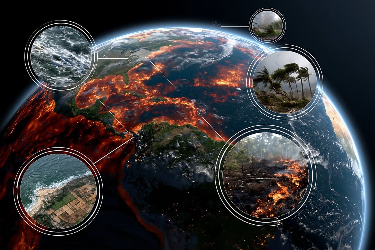
Next year could be the warmest on record as a “super El Niño” is set to emerge, experts have warned.
Nasa, meanwhile, has released new images of a “super El Niño” that will bring catastrophic consequences to the planet.
As per the experts, this phenomenon could supercharge extreme weather events and push global temperatures to record heights next year if it develops.
This is why meteorologists are keeping a close eye on the climate patterns developing in the Pacific Ocean that will enable stronger predictions about what’s to come in the year ahead.
El Niño is a naturally occurring climate phenomenon characterized by the warming of sea surface temperatures in the central and eastern tropical Pacific Ocean.
It alters global weather patterns, and this leads to heavy rains and flooding in some regions and severe droughts in others.
The warming phase of the sea surface temperature is known as "El Niño" and the cooling phase as "La Niña".
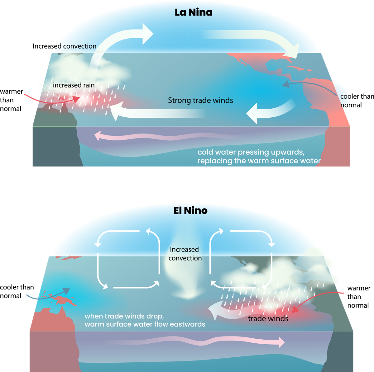
Experts say that a so-called “super El Niño” could supercharge extreme weather events and push global temperatures to record heights next year if it develops.
It could also lead to other severe crises, such as food shortages and major humanitarian problems all around the globe.
While these waves of higher, warmer water move eastwards across the Pacific, ahead of the El Niño emerging, Nasa has captured images of the sea level data.
It might be upon us later in the year and might potentially cause heavy rainfalls in some regions but deficits in others.
In 2026 satellite data, several of these waves of higher, warmer water have shown up, which is why the experts are alarmed.
A swell of warm water is shown hundreds of miles wide, which has arrived in the Pacific off the coast of South America.
According to Nasa, as water expands when it warms up, a rise in “elevation of an area of the ocean indicates increasing ocean temperatures”.
A satellite which was launched by the space agency in 2020 and led by European Space Agency (ESA) measures and maps water height for the entire ocean every 10 days down to fractions of an inch.
When it comes to the infamous El Niño, the satellite tracks what are referred to as warm Kelvin waves.
Nasa explains that “these waves typically form after brief periods when winds over the far western equatorial Pacific Ocean shift from prevailing easterlies - moving from east to west - to westerlies”.
“That effect, combined with a general weakening of easterly winds along the equator, causes water in the tropics of the western Pacific to get warmer and sea levels to rise.”
“While this year’s event started a bit later than the big El Niños of 2015 and 1997, it’s beginning to catch up. We’ll see how big it gets”, sea level researcher and project scientist Josh Willis said.
So far, the strongest El Niño the world has seen was that one in the 90s, which reportedly killed 23,000 people and caused between £21-28 billion in damage.
Floods, cyclones, droughts and wildfires were caused by the weather phenomenon.
In the UK, meanwhile, some of the worst flooding was seen in December 2015, and this was also linked to El Niño.

News

News

News

News
British Army cancels tank and helicopter drills as funding crisis grounds troops
Key British Army training exercises with Challenger 2 tanks and Apache helicopters have been halted until the end of the year due to acute cash shortages.
News
1 day ago
UK responds after Argentina renews claims to Falklands and sanctions oil fields
Argentinean President leveraging Donald Trump’s perceived indifference toward British defence Argentinean President Javier Milei has escalated sovereignty claims over the Falkland Islands by threatening punitive sanctions against oil companies operating in the region’s Sea Lion oilfield. The hardline move follows remarks from Donald Trump suggesting the US might not intervene to defend the British territory […]
News
1 day ago

News
Calls for Farage to face criminal investigation after appearing to accept ‘illicit foreign donations’ in under
News