


News
Share
Published 11:39 26 Nov 2024 GMT
Updated 13:02 26 Nov 2024 GMT
This article contains affiliate links, we may earn a commission on any sales generated from it.
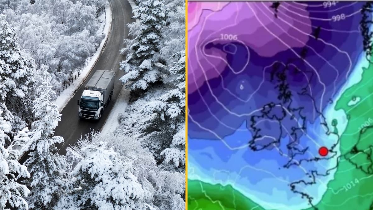
A new weather map covered in purple predicts some freezing temperatures for the UK in the coming days.
Over the last week, large parts of the country have been battered by Storm Bert, with heavy snow, rain and strong winds causing havoc.
Whilst temperatures became milder for many over the weekend, it looks like they'll be returning to a more seasonal norm in the coming days with people looking for ways to stay warm as the mercury plummets.
According to weather maps from WX Charts, most of the UK will experience temperatures between 0-5C. However, a large, ominous purple area of much lower temperatures can be seen approaching the country in the top left corner of the chart, which is a forecast for Wednesday 4 December.
This could mean the mercury dropping as low as -10C according to WX Charts, which uses data from MetDesk.
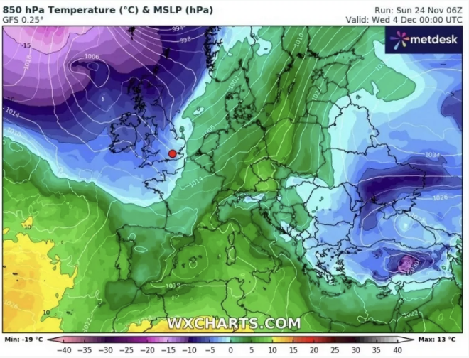
The Mirror reports that Wales, northern England and Scotland could experience icy temperatures after midnight on December 6.
With the freezing weather set to return people will be looking for ways to stay warm without breaking the bank on expensive heating costs.
A great way to keep toasty while it's cold outside is to stick another layer on and wrap up warm with viral hoodie blankets like the Oodie being one of the best ways to stave off the winter frost, and can mean you don’t need to have the heating on at all.
The cold temperatures last week were caused by cold Arctic air which was "firmly in place over the UK", according to Met Office Chief Meteorologist Neil Armstrong.
The Met Office's long range forecast for the period from 30 November to 9 December predicts some chilly temperatures for the start of the festive season.
It reads: "Mainly dry with some clear or sunny spells but rather cold towards the southeast at first as high pressure over the continent extends its influence here. Cloudier, windier and milder in the north and west with some outbreaks of rain.
"Early next week, it looks like the rain in the west will edge further east, bringing a short spell of rain to the east. High pressure may then re-assert itself close to or over the UK through early December.
"The largely dry, settled theme may be punctuated by brief unsettled spells though with areas of low pressure possibly crossing the UK, bringing some spells of wind and rain. Temperatures generally near average, but some overnight frost is likely, and rather cold by day where any fog persists."
Explore more on these topics:

News

News

News

News
Model recruiter who allegedly introduced young women to Jeffrey Epstein found dead
He was found dead at home A French model recruiter who allegedly introduced young women to Jeffrey Epstein has been found dead. The body of Daniel Siad was found in his house in Colombes, a Paris suburb, the Nanterre prosecutor’s office confirmed to the BBC. A cause of death has not yet been released with an […]
News
20h
EasyJet flight to UK forced to turn back after mass 10-person brawl breaks out mid-air
A different kind of turbulence An easyJet flight heading from Tenerife to Liverpool was forced to make an unexpected return to the airport after a large fight broke out among passengers mid-flight. Flight EZY3352 took off from Tenerife South Airport just before 8pm local time and reportedly had a calm start to the journey. However, […]
News
22h
Andy Burnham has announced change to your bills after just 24 hours in charge
News


