


News
Share
Published 13:24 14 Nov 2025 GMT
Updated 13:30 14 Nov 2025 GMT

Here are all the areas in the UK set to be hit by snowfall next week revealed after the Met Office has delivered a verdict on forecasts of snow as far south as London.
Temperatures this autumn have been unusually high, bringing mild but often damp weather to much of the UK.
As we hit mid-November, the mercury is finally set to drop to chillier temperatures with many weather maps forecasting blanketing snow as far south as London.
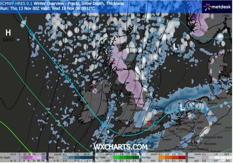
The ever-divisive WXCharts show the UK covered with a 500-mile blanket of snow, while many weather apps suggest we could see overnight temperatures as low as 0C next week.
However, we've rounded up multiple forecasts for a number of locations across the UK to bring you our best summary of next week's snowfall.
| Region | Rough Ensemble‑Based Snow Risk (next week) |
|---|---|
| Scottish Highlands / Northern Scotland | High risk for snow showers on hills — freezing levels drop low, so wintry precipitation is quite likely in elevated terrain. (Met Office) (Snow forecast) |
| Eastern / Northern Scotland (non‑mountain) | Moderate–High risk of sleet or light snow, especially on higher ground. (Met Office) (Met Office) |
| Northern England (Pennines, North Yorks, Cumbria) | Moderate risk — some model runs expect sleet or snow on uplands; lower ground less likely. (Met Office) |
| North Wales (uplands) | Moderate risk — hills could see wintry showers, though not necessarily heavy accumulation. (Met Office) (Met Office) |
| Southern England / Midlands / South Wales | Low to Moderate risk — much of the precipitation is modelled as rain / sleet in many runs; snow in lowlands is less likely, though some ensemble runs hint at isolated flurries. (Met Office) (Met Office) |
| Northern Ireland | Moderate risk in some north / higher ground — model talk suggests cold air could allow for sleet or light snow in places. (Met Office) (Met Office) |
| Coastal / Low-Lying Regions (General) | Low risk for substantial snow, though frost and ice risk is more certain in cold nights. (Met Office) (Met Office) |
Of course speculation is always rife when snow is on the cards, so the gold-standard Met Office have stepped in to give their verdict.
During his long forecast, Meteorologist Alex Deakin predicted that a frosty weather system from Iceland is expected to hit the UK from Scotland, making its way down through Wales next week.
He warned of "some sleet, some snow, something a bit wintry" in places.
This system will continue to push south.
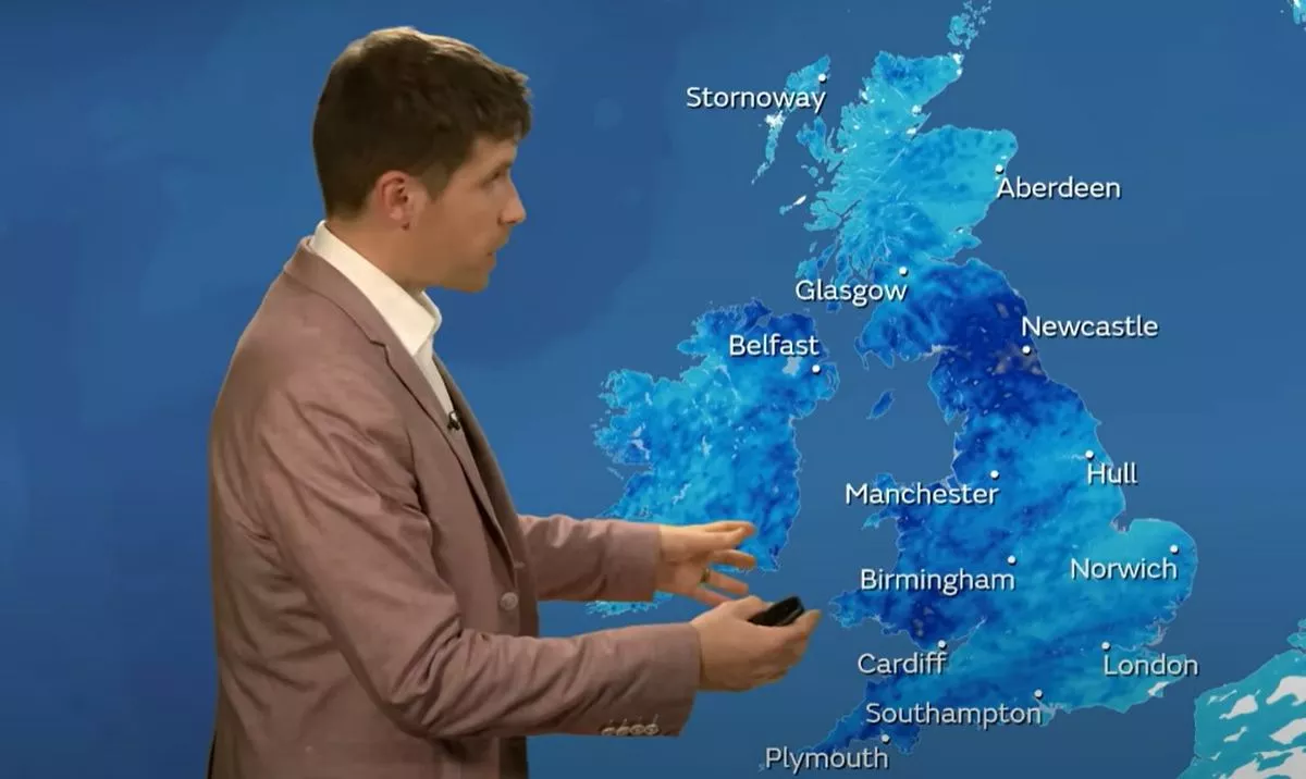
Alex said: "Through the middle and end of next week, things perhaps get a bit more interesting. There's the potential for a weather system to push its way southwards as the high drifts away towards the west.
"If this happens, we could get some snow on the northern edge of it, which then feeds its way southwards. This means we could see a bit of snow across many places.
"Looking at this chart for Thursday (November 20), even across southern parts of the country, it’s highlighting around a 20% - maybe even greater than 20% - chance of seeing more than 1cm of snow. So, things could turn quite wintry."
Well, there you have it, as far as snow forecasts go, this one is certainly more credible than most.
So, it might just be time to locate those gloves and scarves and get ready for a stroll in a winter wonderland.
Explore more on these topics:

News

News

News

News
Model recruiter who allegedly introduced young women to Jeffrey Epstein found dead
He was found dead at home A French model recruiter who allegedly introduced young women to Jeffrey Epstein has been found dead. The body of Daniel Siad was found in his house in Colombes, a Paris suburb, the Nanterre prosecutor’s office confirmed to the BBC. A cause of death has not yet been released with an […]
News
8h
EasyJet flight to UK forced to turn back after mass 10-person brawl breaks out mid-air
A different kind of turbulence An easyJet flight heading from Tenerife to Liverpool was forced to make an unexpected return to the airport after a large fight broke out among passengers mid-flight. Flight EZY3352 took off from Tenerife South Airport just before 8pm local time and reportedly had a calm start to the journey. However, […]
News
10h
Andy Burnham has announced change to your bills after just 24 hours in charge
News


