



news
Share
Thunderstorm Warning Covers 70 Areas With 2cm Hail and Flood Risk
Published 14:11 25 Aug 2026 BST
Updated 11:45 25 Aug 2026 BST
Homenews
Thunderstorm Warning Covers 70 Areas With 2cm Hail and Flood Risk
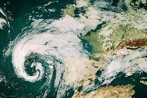
The Met Office has issued its second thunderstorm warning of the week, with 70 areas of England and Wales facing lightning, hail of up to 2cm, flooding and strong winds on Thursday. The yellow warning runs from 6am to 10pm and follows a separate alert covering 59 areas on Wednesday, in force from 3am until 10pm.
Where the thunderstorm warning applies
The warnings cover the West and East Midlands, the North West, the South East, the South West, the east of England and parts of Wales. A band of storms moves northwards on Wednesday morning, with 20 to 30mm of rain possible in under an hour and 40 to 50mm in two to three hours in places, bringing surface water flooding, large hail and frequent lightning.
On Thursday, a slower-moving band could drop 20 to 30mm in three hours and up to 50mm over 12 hours, with a small chance of more than 75mm over east-facing high ground. Homes and businesses could be flooded quickly, the Met Office said, with buildings damaged by floodwater, lightning, hail or strong winds — and a danger to life from fast-flowing or deep floodwater.
There is a slight chance that power cuts could occur and other services to some homes and businesses could be lost. There is a small chance that some communities become cut off by flooded roads.
Met Office
The rain lands on ground parched by a record-breaking dry summer that brought this summer’s amber heat health alerts and left much of the country in drought. Forecasters have cautioned it will not solve the shortfall overnight, and heavy rain on hard ground raises the risk of the sudden flooding seen when flash flooding in Gwaelod-y-Garth hit south Wales.
People living in flood-prone areas are being urged to prepare a flood plan and an emergency flood kit before the storms arrive.
Explore more on these topics: