An “unprecedented” El Nino event next year will cause the hottest year on record in the UK, as per the Met Office which has issued a new warning.
Since records began, the summer of 2026 is set to be the hottest on record in the UK, as in August, even average conditions mean that the temperatures will surpass the records set last year.
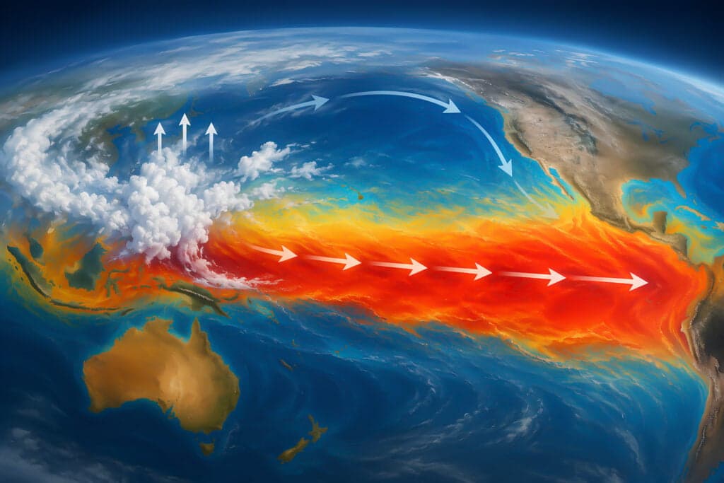
An El Nino event is declared when sea temperatures in the eastern Pacific rise 0.5C above the long-term average.
Due to this phenomenon, the weather pattern impacts rainfall and average temperatures across the globe.
Over the coming months, the 2026 El Nino is forecast to raise sea temperatures more than 3C, as the Met Office said that would make the weather event “the largest since the 19th century”.
What El Nino means for the UK
El Nino recurs every two to seven years, when Pacific trade winds weaken and warm water spreads east, releasing heat into the atmosphere.
With below-average monsoon rains in India and suppressed Atlantic hurricane activity, there is growing evidence that those shifts have begun.
"We have many months to go while this event continues to develop," said Dr Zeke Hausfather, a climate scientist at Berkeley Earth, "and that's one of the reasons that we have increased confidence that this will be a record-setting event", Prof Adam Scaife, head of long-range forecasting at the Met Office said.
How the El Nino conditions developed
According to the US National Oceanic and Atmospheric Administration (NOAA), El Nino conditions are now under way in the tropical Pacific.
The agency said that “El Nino conditions developed over the past month, as shown by above-average sea surface temperatures (SSTs) across the central to eastern equatorial Pacific Ocean”.
As a sign that the atmosphere is now responding to the warmer ocean, not just the ocean warming on its own, NOAA has also seen the winds above the equatorial Pacific begin to shift.
The biggest concern about what El Nino is and why could it mean record temperatures is that all this is happening on an already much hotter planet.
According to Prof Adam Scaife, “we do need to worry about the impacts”.
“The current El Nino is… riding on top of a substantial amount of global warming.”
“This means that the actual temperatures in affected regions could well be unprecedented, as the warming from El Nino is being topped up by climate change.”
‘Give this guy the support he needs to defeat the modern-day Hitler.’ Piers Morgan has urged Donald Trump to side with Ukraine and Volodymyr Zelensky in their war against Russia. There have been strained tensions this week between Ukraine and the US as Trump has cosied up to Vladimir Putin with diesel deals and sham […]
The US president has done a U-turn The execution of a Nidal Malik Hasan will no longer be livestreamed, US President Donald Trump has said. Last week, it was announced that the execution of Hasan, the man behind the Fort Hood shooting, would be livestreamed. The shooting, which happened in Texas in 2009, killed 13 […]
The royal was looking after a small child at the time A royal was found passed out on a street in London after a ‘cocaine binge’ while looking after a child, a court has heard. Mahrah Al Nahyan, 32, is a member, through marriage, of one of the world’s richest royal families, the Abu Dhabi […]