


News
Share
Published 11:33 15 Oct 2025 BST
Updated 11:33 15 Oct 2025 BST

The UK has been forecast '7cm of snow per hour' according to new advanced range weather maps.
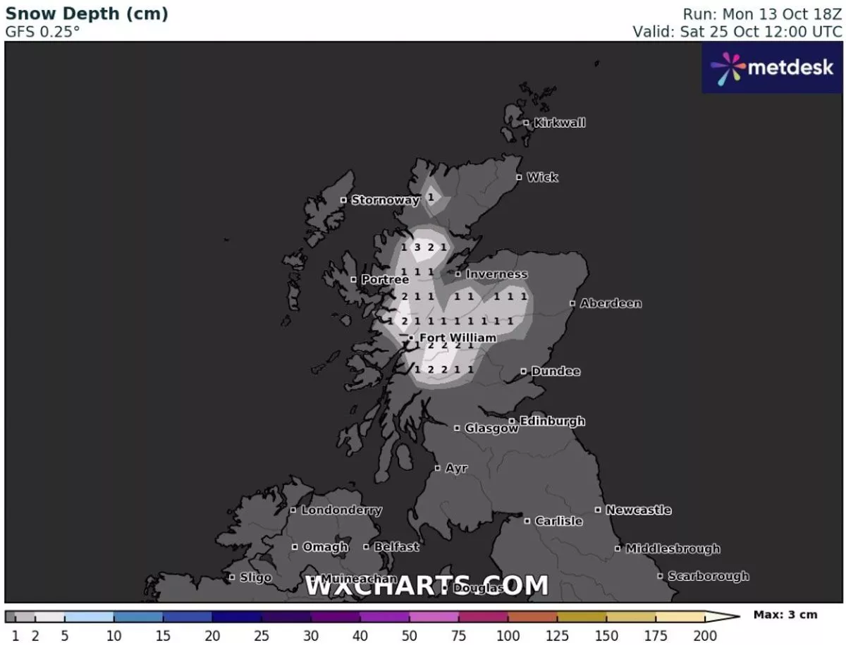
An Arctic blast is due to arrive on Saturday, October 25, according to WXCharts, leaving areas north of Edinburgh coated in snow.
Areas including Inverness, parts of the Cairngorms and the Highlands are due to see consistent snow, with most places seeing around 2.5cm per hour.
The Scottish Highlands and Sutherland are expected to see the heaviest snow, with data showing that it could reach as much as 7cm per hour.
It looks to be the first heavy snowfall of the season, as Arctic air comes further south.
The Met Office has issued a warning over a "transition period" towards the end of October.
They warned over weather systems moving eastwards, leading to a mix of rain and strong winds across the country.
In the forecast for October 19 to October 28, the forecaster says the UK can expect "a transition to more unsettled conditions than of late [...] at the start of this period" and "low pressure from the Atlantic mov[ing] gradually eastwards across the UK."
They added: "This will bring an increasing chance of rain or showers fairly widely, perhaps accompanied by some strong winds at times. It is likely to remain fairly changeable as further pulses of rain or showers affect parts of the UK through much of this period, but interspersed with some drier and brighter interludes.
"Towards the following weekend, and final week of October, high pressure may build to the west of the UK, and with low pressure to the east this may lead to a cooler and slightly drier northwesterly flow with a few showers."

News

News

News

News
Model recruiter who allegedly introduced young women to Jeffrey Epstein found dead
He was found dead at home A French model recruiter who allegedly introduced young women to Jeffrey Epstein has been found dead. The body of Daniel Siad was found in his house in Colombes, a Paris suburb, the Nanterre prosecutor’s office confirmed to the BBC. A cause of death has not yet been released with an […]
News
9h
EasyJet flight to UK forced to turn back after mass 10-person brawl breaks out mid-air
A different kind of turbulence An easyJet flight heading from Tenerife to Liverpool was forced to make an unexpected return to the airport after a large fight broke out among passengers mid-flight. Flight EZY3352 took off from Tenerife South Airport just before 8pm local time and reportedly had a calm start to the journey. However, […]
News
11h
Andy Burnham has announced change to your bills after just 24 hours in charge
News


