









News

Share
Published 08:33 23 Jan 2025 GMT
Updated 08:58 23 Jan 2025 GMT
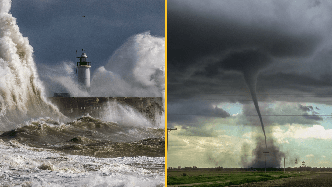
A tornado warning and a danger to life alert has been issued in the UK ahead of Storm Eowyn.
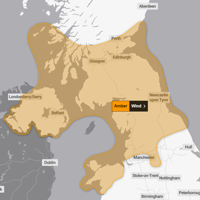
The Met Office upgraded yellow warnings to amber alerts yesterday for much of the UK on Friday, warning there could be a 'danger to life' due to flying debris.
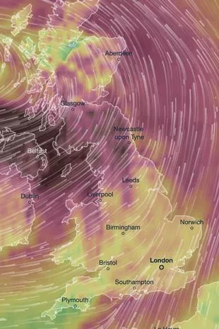
An alarming weather map has shown exactly when and where Storm Eowyn will hit the UK with 90mph winds, rain and snow all on the cards.
Now, the European Storm Forecast Experiment (Estofex) has issued a level two alert, warning that the development of a tornado "cannot be ruled out".
With the South of England most at risk, much of the area from Bristol to Bournemouth to London has been put on alert from "severe wind gusts with a few tornado events possible".
Storm Eowyn is the first storm of 2025 and is set to be one of the most brutal as forecasters predict a battering for the UK.
Those that live in exposed coastal areas on the Atlantic will be the most affected, with people in Northern Ireland, northern England, northwestern Wales and Western Scotland being told to prepare for landfall.
Parts of Northern England and Scotland are expected to be affected by the storm from 6am through to 9pm on Friday.
A timelapse can be seen by using the map here to show the impending Storm Eowyn's path and where it is likely to have the most impact, with travel delays and power outages expected.
Deputy chief meteorologist at the Met Office, Mike Silverstone said: “Storm Éowyn will bring a period of very unsettled, potentially disruptive, weather to the UK through Friday and into Saturday.
"The strongest gusts are likely to be felt across parts of Northern Ireland, northern England, northwestern Wales and western Scotland, where exposed sites could get gusts in excess of 80mph, which has the potential to cause impacts for those in these areas.
“There will also be some heavy rain, bringing some unpleasant conditions to end the week.
"The initial warning for Storm Eowyn has been issued several days in advance, so it’s important to stay up to date with the forecast as further details emerge in the coming."
There are separate yellow warnings for wind, rain and snow covering various parts of the UK on Friday, with a yellow warning for wind in Scotland continuing until 3pm on Saturday.
Meanwhile a rare, red warning has been issued by Ireland's weather service ahead of the arrival of Storm Eowyn, threatening to bring "severe, damaging and destructive gusts".
As of now, the Met Office can only guess the path Storm Eowyn will take, although peak gusts of up to 90mph winds are expected in some areas.
Meanwhile, snow could even be on the way as the weather system initially meets with cold air.
RAC Breakdown spokesperson Alice Simpson said: “The wet and windy weather brought about by Storm Éowyn will make driving much more of a challenge towards the end of this week, especially for those in the west of England, Scotland and Northern Ireland.
"Strong winds mean there’s a higher likelihood of fallen branches and trees on rural routes between motorways and A-roads, which can obstruct journeys and puncture tyres if not carefully avoided.”

News

News

News

News
Homes evacuated after ‘pipe bomb’ explosion in Belfast
Police have asked the public to avoid the area A number of homes have been evacuated after an explosion at a property in north Belfast. The incident is reported to have happened in the Stanhope Street area of the city. Belfast Live report that it is believed that a pipe bomb exploded at a property […]
News
1 day ago
Government plans to expand BBC licence fee with proposed ‘YouTube Tax’
YouTube, Netflix and Disney+ could face new BBC fee rules Watching videos online could soon come with an unexpected cost, as the government considers extending the BBC licence fee to streaming services and digital platforms. The proposed shake-up could bring websites and services such as YouTube, Netflix, Amazon Prime Video and Disney+ under the same […]
News
1 day ago
Body of British tourist who died abroad goes missing from morgue before eerie twist
News