


News
Share
Published 11:45 29 Jan 2018 GMT
Updated 14:50 29 Jan 2018 GMT

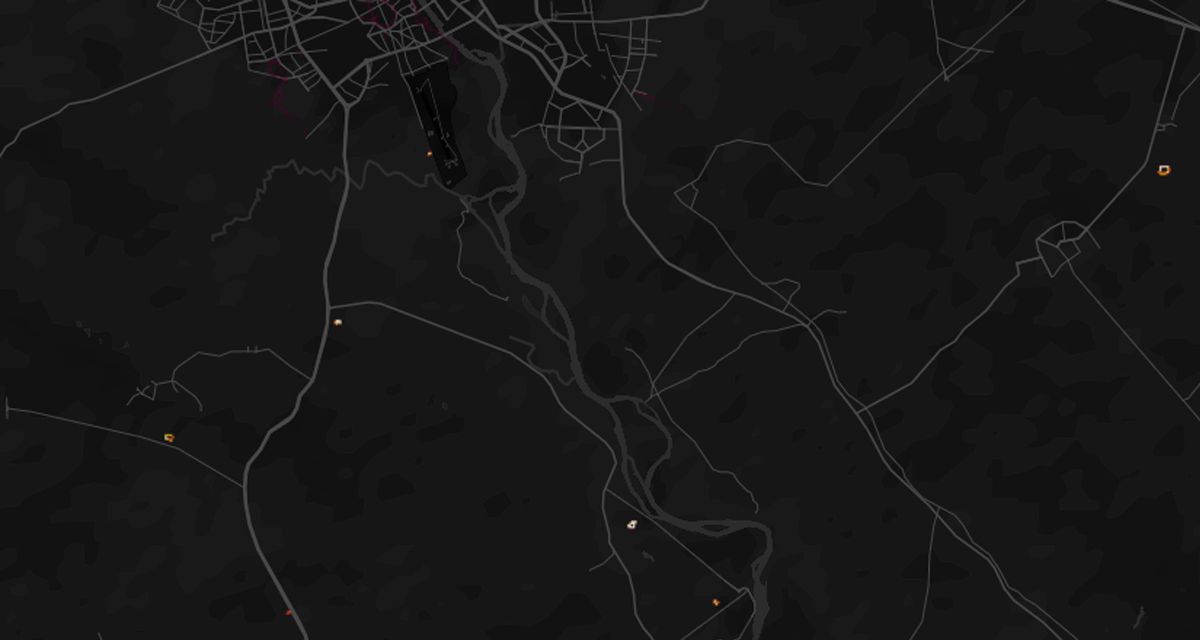 Parkrun Mosul hotspots (Credit: Strava)[/caption]
But it would appear the only Strava users in some third world countries are foreign military personnel on active service.
As such, their preferred exercise routes stand out brilliantly against the map's vacant dark background, apparently demarcating secret military bases and forward operating positions.
Such locations are evident in Afghanistan, Djibouti, Somalia, Syria and around Mosul in Iraq.
Known UK base RAF Mount Pleasant in the Falkland Islands is lit up brightly on the heatmap, as are nearby bodies of water Lake Macphee and Gull Island Pond, apparently popular swimming spots with the 1,000 British personnel based there.
[caption id="attachment_159922" align="alignnone" width="1200"]
Parkrun Mosul hotspots (Credit: Strava)[/caption]
But it would appear the only Strava users in some third world countries are foreign military personnel on active service.
As such, their preferred exercise routes stand out brilliantly against the map's vacant dark background, apparently demarcating secret military bases and forward operating positions.
Such locations are evident in Afghanistan, Djibouti, Somalia, Syria and around Mosul in Iraq.
Known UK base RAF Mount Pleasant in the Falkland Islands is lit up brightly on the heatmap, as are nearby bodies of water Lake Macphee and Gull Island Pond, apparently popular swimming spots with the 1,000 British personnel based there.
[caption id="attachment_159922" align="alignnone" width="1200"]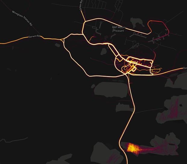 RAF Mount Pleasant on the Falkland Islands (Credit: Strava)[/caption]
Military analysis Tobias Schneider tweeted : “In Syria, known coalition (ie US) bases light up the night.
“Some light markers over known Russian positions, no notable colouring for Iranian bases."
Zooming in on the larger bases clearly reveals their internal layout, as mapped out by the tracked jogging routes of numerous soldiers.
These bases themselves are not visible on the satellite views of Google Map but can be clearly seen through Strava.
[caption id="attachment_159921" align="alignnone" width="1200"]
RAF Mount Pleasant on the Falkland Islands (Credit: Strava)[/caption]
Military analysis Tobias Schneider tweeted : “In Syria, known coalition (ie US) bases light up the night.
“Some light markers over known Russian positions, no notable colouring for Iranian bases."
Zooming in on the larger bases clearly reveals their internal layout, as mapped out by the tracked jogging routes of numerous soldiers.
These bases themselves are not visible on the satellite views of Google Map but can be clearly seen through Strava.
[caption id="attachment_159921" align="alignnone" width="1200"] A hotspot of activity in Helmand province, Afghanistan (Credit: Strava)[/caption]
Area 51 also records a lone cyclist taking a ride from the base along the west edge of Groom Lake, marked on the heatmap by a thin red line.
When Strava released the heatmap it said: “This update includes six times more data than before – in total 1 billion activities from all Strava data through September 2017. Our global heatmap is the largest, richest, and most beautiful dataset of its kind. It is a direct visualisation of Strava’s global network of athletes.”
A statement issued by the company today said: "Our global heatmap represents an aggregated and anonymised view of over a billion activities uploaded to our platform. It excludes activities that have been marked as private and user-defined privacy zones. We are committed to helping people better understand our settings to give them control over what they share. For more information about Strava privacy, please visit our website."
A hotspot of activity in Helmand province, Afghanistan (Credit: Strava)[/caption]
Area 51 also records a lone cyclist taking a ride from the base along the west edge of Groom Lake, marked on the heatmap by a thin red line.
When Strava released the heatmap it said: “This update includes six times more data than before – in total 1 billion activities from all Strava data through September 2017. Our global heatmap is the largest, richest, and most beautiful dataset of its kind. It is a direct visualisation of Strava’s global network of athletes.”
A statement issued by the company today said: "Our global heatmap represents an aggregated and anonymised view of over a billion activities uploaded to our platform. It excludes activities that have been marked as private and user-defined privacy zones. We are committed to helping people better understand our settings to give them control over what they share. For more information about Strava privacy, please visit our website."Explore more on these topics:

News

News

News

News
Dozens of tourists including Brits hospitalised after swimming pool poisoning near Marbella
Holiday gone wrong A swimming pool malfunction at a hotel near Marbella left dozens of holidaymakers in hospital after a toxic gas leak sparked a major emergency. The incident happened at an unnamed hotel in Benahavís, where a fault in the pool’s chemical system exposed guests to dangerous fumes. Around 60 tourists, including British visitors, […]
News
58 min
Andy Burnham has announced change to your bills after just 24 hours in charge
The policy will be funded by scrapping the digital ID scheme. Andy Burnham has announced an immediate measure to tackle the cost of living and bring bills down, less than 24 hours after becoming prime minister. On Monday, Burnham officially replaced Keir Starmer as prime minister and delivered his first speech outside Number 10. In the address, […]
News
2h
Only three UK cinemas can screen The Odyssey as intended
News


